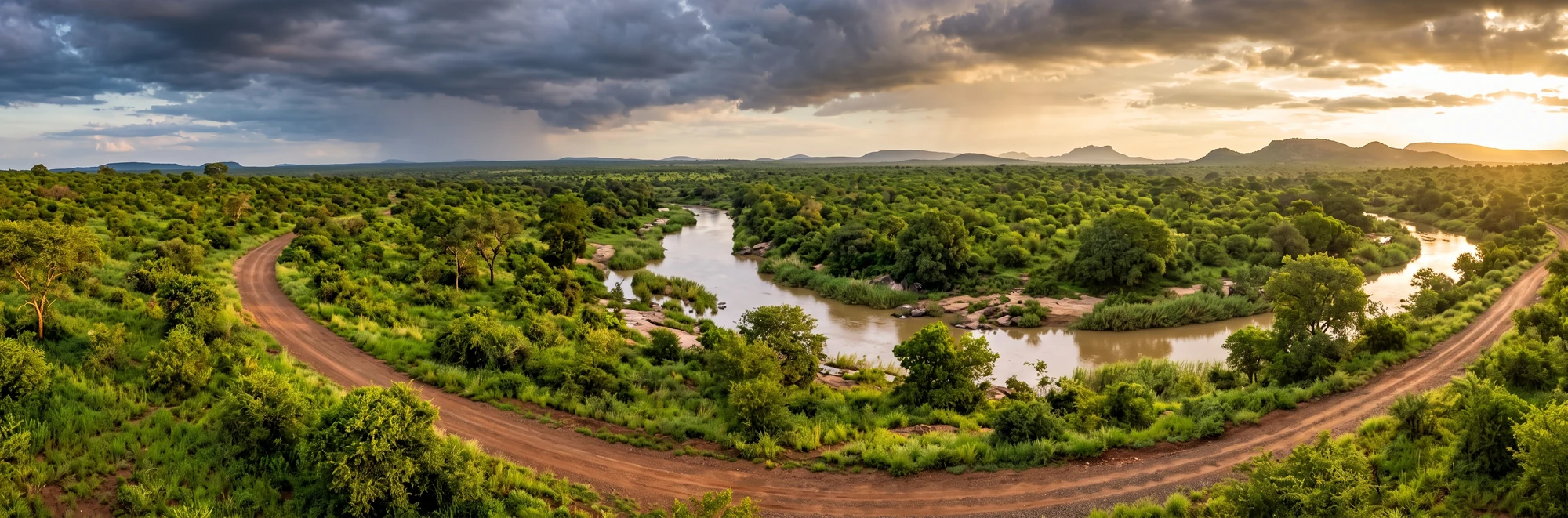
Kruger has two seasons that matter to you as a self-driver: a hot, humid summer with afternoon thunderstorms from about October to March, and a dry, sunny winter from about May to September with cold dawns and warm afternoons. April and late September to October are the changeover months. Here are typical temperatures and rainfall for each month, what each month feels like from the car, and how the weather shapes roads, bush and game viewing.
The Two Seasons at a Glance
Summer (rainy season), roughly October to March. Days are hot, often 30 to 35°C, and nights stay warm at around 17 to 21°C. Most of the year's rain falls now, usually as short, heavy afternoon or evening storms rather than all-day rain. The air is humid and there is more cloud than in winter.
Winter (dry season), roughly May to September. Skies are clear, rain is rare and the air is dry. Afternoons are pleasant at around 26 to 28°C, but dawn in June and July is cold, with typical lows of about 6°C at Skukuza. The bush thins out and animals concentrate around permanent water.
Rainfall in Kruger is also very variable from year to year. A long-term analysis of the Skukuza weather station by the South African Weather Service describes the climate as highly variable and prone to both droughts and floods, so treat every number below as an average, not a promise.
Month-by-Month Climate Table (Skukuza, Southern Kruger)
These are rounded, typical values for Skukuza, the park's main camp at about 265 m above sea level. They are based on long-term station averages (temperature normals 1991 to 2020) and cross-checked against several climate sources. Where sources differ, the rainfall is shown as a range. A "rain day" is any day with measurable rain, which in summer is often a single short storm.
| Month | Avg max (°C) | Avg min (°C) | Rain (mm) | Rain days |
|---|---|---|---|---|
| January | 33 | 20 | 95 to 110 | 9 to 10 |
| February | 33 | 21 | 95 to 110 | 8 to 10 |
| March | 32 | 19 | 70 to 80 | 8 to 9 |
| April | 31 | 16 | 35 to 40 | 5 to 6 |
| May | 28 | 10 | about 15 | 3 |
| June | 27 | 6 | about 10 | 2 |
| July | 27 | 6 | about 10 | 1 to 2 |
| August | 28 | 9 | about 10 | 2 |
| September | 31 | 14 | 25 to 30 | 3 |
| October | 31 | 17 | 40 to 45 | 6 to 7 |
| November | 32 | 19 | 65 to 85 | 9 to 11 |
| December | 33 | 20 | about 95 | 9 to 10 |
| Year | 31 | 15 | about 565 to 635 | 65 to 75 |
Two things stand out. Daytime highs barely change through the year, so the real difference is at night and at dawn. And about three quarters of the rain falls between November and March.
North vs South, Lowveld vs Escarpment
Kruger is about 360 km long, and its climate is not the same everywhere.
Rainfall drops from south to north. Research on the park's rainfall gives roughly 700 to 750 mm a year in the wetter south-west around Pretoriuskop, falling to about 450 mm or less in the far north around Pafuri. The north is also generally hotter and more arid in summer, especially along the Limpopo River valley, where mopane and baobab country replaces the denser southern bush. We could not find two reliable, matching monthly tables for a northern camp, so we do not give one here. Use the Skukuza table as a guide and expect the north to be a little drier and, in summer, often hotter. Our north vs south Kruger guide explains what that means for your trip.
Pretoriuskop is the cool, wet corner. Pretoriuskop sits higher than the rest of the south and is usually described as the wettest and one of the coolest areas of the park.
The escarpment is a different world. If you drive in via Graskop or the Panorama Route, you start high up (Graskop sits at about 1,400 m) in a mist belt where warm, moist Lowveld air rises and cools. Expect fog, drizzle and noticeably cooler temperatures up there, then heat as you drop down to the Lowveld. In summer, drive the escarpment roads early and slowly: mist can roll in within minutes.
What Each Month Feels Like for a Self-Driver
January. Peak summer. Hot, humid days, warm nights and a good chance of an afternoon thunderstorm. This is one of the wettest months and the month most associated with floods (see below). The bush is at its greenest and densest.
February. Much like January: hot, sticky and stormy. Rivers can run strongly. Grass is tall, so scanning roadside bush is harder.
March. Still hot, but the rain eases as the month goes on.
April. Transition month. Rain drops off sharply, humidity falls and the light gets clearer. Mornings start to feel fresh, and the bush slowly begins to dry.
May. The start of the dry season. Days around 28°C, dawns around 10°C. Comfortable temperatures, little rain and bush that is starting to thin out.
June. The coldest nights of the year. At gate opening you may sit in the car at around 5 to 6°C, warming to about 27°C by early afternoon. That swing of more than 20°C in one day is what catches visitors out.
July. Like June: dry, sunny, cold dawns and warm afternoons.
August. Still dry, but warming up. Winds pick up in the late dry season, and dust becomes a factor on gravel roads. Water is scarce in the bush, so waterholes and rivers become the focus (see our dry-season waterholes guide).
September. Hot, dry and often windy, with the bush at its barest. Afternoons are back above 30°C. The first scattered showers can arrive late in the month, but timing varies from year to year.
October. The buildup month. Heat and humidity rise, clouds build in the afternoon and the first proper storms usually arrive. Before the rain it can feel oppressive. After the first good rains, the bush turns green remarkably quickly.
November. The rainy season is underway, with frequent afternoon storms and more cloud. Fresh grass draws grazers, and the wet season is when you see newborn impala, wildebeest and zebra.
December. Hot, humid and stormy, and one of the wettest months. Long days, but heat builds early, so plan to be out at gate opening.
For how heat, rain, cloud and wind change animal behaviour hour by hour, read How Weather Changes Animal Behaviour in Kruger.
How the Weather Affects Your Trip
Gate times. Gates open earlier and close later in summer, following daylight. Check the current timetable on our gates page and read gate times explained before you plan long drives.
Dirt roads and bridges. After heavy rain, SANParks often closes gravel roads, sometimes across whole sections of the park, and asks visitors to stay on tar. Low-water bridges can flood and close, and rivers can keep rising for a while after the rain stops. Never drive through water flowing over a bridge and never move a closure barrier. If a big storm is coming, choose tar and stay close to camp. Our guides to dirt roads and whether you need a 4x4 cover the rest.
Vegetation and game viewing. In winter the bush thins out, surface water dries up and animals gather at rivers and dams, which makes them easier to find. In summer, water is everywhere, so animals spread out and dense green bush hides them, but you get newborn animals, migrant birds and lush scenery. Neither season is "bad", they just reward different strategies. See seasonal highlights for what to look for month by month.
Fire. The dry season is also when fires are most likely. If you see smoke or freshly burnt veld, it is often deliberate management, explained in our post on controlled burning in Kruger.
Extremes: Heat, Frost and Floods
Heat over 40°C. The averages hide hot spells. At Skukuza, temperatures above 40°C have been recorded in every month from September to April, and the station's records include readings above 45°C. Even in winter, a warm spell can push afternoons into the mid-30s. On very hot days, drive early and late, rest at midday and carry plenty of water.
Frost and sub-zero mornings. Kruger is generally described as frost-free, and minimum temperatures rarely drop below freezing. But it can happen: Skukuza has recorded lows of around -4°C in June, July and August. Pack a proper warm layer for winter dawns, not just a fleece.
Floods. Big floods are rare but real, and they usually come between January and March:
- February 2000: The Sabie River and its tributaries flooded the south. Skukuza, Pretoriuskop, Lower Sabie and Crocodile Bridge camps had to close, and Skukuza suffered heavy damage.
- January 2012: Torrential rain cut off many camps, closed several gates and roads, and a park helicopter airlifted stranded tourists.
- February 2023: Lower Sabie, Crocodile Bridge, Biyamiti and Talamati were closed by flooding in the south, guests were moved out of high-risk areas, and the Sabie River flooded the low-level bridge at Lower Sabie.
- January 2026: One of the worst floods on record. The Sabie, Olifants, Letaba and Luvuvhu rivers burst their banks, hundreds of guests were evacuated from camps including Letaba, Shimuwini and Sirheni, and the road link between north and south was cut. Repairs are estimated at around R950 million and are expected to take years, so some roads and bridges may still be on temporary routes or detours.
If you travel in summer, check SANParks' official channels for road and camp updates before and during your trip.
Thunderstorms, Lightning and UV
Summer storms build fast, often in the afternoon. South Africa has high lightning activity in the summer rainfall season, roughly October to March. A hard-top car with the windows closed is a safe place to be, whereas open game vehicles, tents, picnic-site shelters and soft-tops are not. If you are walking around a camp or picnic site when thunder starts, get into a building or your car and wait about 30 minutes after the last thunder before going out again.
The sun is just as serious. On clear summer days the UV index regularly reaches the extreme range (11 or higher), and it is still moderate to high in winter. Wear a hat and sunscreen, and remember that an arm resting on an open window burns quickly on a long drive.
What to Wear by Season
Summer: light, breathable, neutral-coloured clothing, a wide-brimmed hat, sunglasses, a light rain jacket and long sleeves for the evening (also for mosquitoes).
Winter: layers. A warm jacket, beanie and even gloves for the open-window early drive, then T-shirt weather by midday.
Our full packing list by season and game drive attire guide have the details.
Weather and Malaria
Kruger lies in a malaria area, and the risk is higher in the warm, wet months, roughly from September or October to May, when mosquitoes breed. Winter is lower risk, not zero risk. Speak to a travel doctor about your dates and route, and read our malaria guide and malaria myths.
Frequently Asked Questions
What is the best time to visit Kruger for weather? For comfortable temperatures and easier game viewing, May to September (the dry winter) is the favourite of most self-drivers: dry, sunny, with cold mornings and warm afternoons. If you prefer green scenery, newborn animals and birding, and do not mind heat and storms, November to March is beautiful. April and May are a good compromise.
What is the rainy season in Kruger? Roughly October or November to March or April. Most rain falls from November to March, typically as short afternoon or evening thunderstorms. December to February are usually the wettest months.
How cold does Kruger get in winter? At Skukuza, June and July dawns average around 6°C, and lows of a few degrees below zero have been recorded, though frost is rare. Afternoons still reach about 26 to 28°C.
How hot does Kruger get in summer? Average highs are around 32 to 33°C from November to March, and hot spells above 40°C occur. Humidity makes it feel hotter.
Does rain ruin a Kruger trip? Rarely. Most summer rain comes as short storms, and the bush is lush and full of young animals and birds. The main impact is that gravel roads and low bridges may close after heavy rain, so keep your plans flexible and stick to tar when told to.