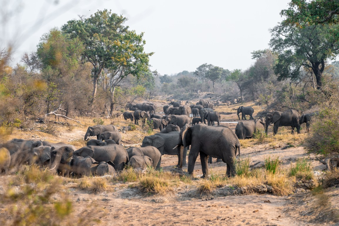
Kruger's far north feels like a different park. Above Shingwedzi the mopane gives way to sandveld, baobabs and, along the Luvuvhu River, a green tropical forest full of birds you will not see further south. There are fewer cars, fewer camps and, honestly, fewer animals per kilometre. Here is how to get there, where to stay, what to see and what the January 2026 floods changed.
If you are still deciding between regions, read north vs south Kruger first.
Important: Check the 2026 Flood Status First
The January 2026 floods hit the north hard. Camps were cut off, bridges and gravel roads were damaged, and recovery has run in phases through the year. This is what we could confirm from the latest sources we found (March to August 2026; the newest SANParks road register we could find is dated 11 August 2026). Treat it as a starting point, not as current status.
| Place | Last confirmed status |
|---|---|
| Punda Maria Gate and Pafuri Gate | Open (March 2026), and the Pafuri border post had reopened |
| Punda Maria Rest Camp | Receiving guests since late January 2026 |
| Shingwedzi Rest Camp | Reopened on 6 March 2026, at first reachable only via Punda Maria or Pafuri Gate |
| Bateleur Bushveld Camp | Receiving guests (March 2026) |
| Sirheni Bushveld Camp | Closed again in March 2026 because of access problems. In August 2026 its S57 access road was listed as partially open, but we could not confirm that the camp has reopened |
| S99 Mahonie Loop (Punda Maria) | Listed as closed in the May and August 2026 road registers |
| S63 Luvuvhu River road (Pafuri) | Partially open in May and August 2026, including access to the picnic site and Crook's Corner |
| S64 Nyala Drive | In May 2026 open for access to Thulamela only |
Before you book, and again on the morning you drive, check the SANParks road closure register and camp updates. Gravel roads marked "No Entry" are closed for a reason: do not drive them, and avoid low-water crossings after rain.
Getting There
Most visitors drive in from Gauteng via the N1 and enter at one of two gates.
Punda Maria Gate is the usual choice. Take the N1 north past Polokwane to Makhado (Louis Trichardt), then the R524 east through Thohoyandou to the gate, about 130 km from Makhado. SANParks gives about 550 km from Johannesburg to the gate. Allow 5 to 6 hours of driving to the gate and closer to 7 hours door to camp with stops. From Polokwane you follow the same N1 and R524 route. From Thohoyandou the gate is only about 65 km away, which makes it the last real town for shopping and fuel.
Pafuri Gate is the northern entrance. You leave the N1 about 40 km south of Musina and take the R525 east via Tshipise, about 127 km to the gate. From Johannesburg it is roughly 600 km. It suits trips heading straight to Pafuri or a Makuleke concession lodge.
Distances inside the park are what catch first-timers out:
- Punda Maria Gate to Punda Maria Rest Camp: about 8 to 10 km
- Pafuri Gate to Punda Maria Rest Camp: well over 50 km (published figures range from about 50 to 75 km)
- Punda Maria Gate to Shingwedzi: about 70 km
- Punda Maria Rest Camp to Shingwedzi: about 70 to 75 km, mostly on tar via the H1-7
With speed limits of 50 km/h on tar and 40 km/h on gravel plus sightings, a 70 km transfer easily takes 2 to 3 hours, so plan around gate times. For flying in and other gate options, see getting there and best gates by arrival city.
Where to Stay
Punda Maria Rest Camp is the northernmost main camp and the obvious base. It sits on a ridge in sandveld about 8 to 10 km from the gate. It is small and old-fashioned: a short self-guided walk inside the camp (the Paradise Flycatcher Trail), a hide over a floodlit waterhole near the fence, a pool, a small shop, a restaurant and fuel.
Shingwedzi is about 70 km to the south on the Shingwedzi River. It is larger, known for elephant and buffalo along the river, and works well as the second stop on a north trip. Pafuri is a long day trip from here, so most people visit Pafuri from Punda Maria.
Bushveld camps: Bateleur (seven cottages, south-west of Shingwedzi) and Sirheni (on Sirheni Dam, off-grid, about 54 km from Punda Maria Gate) are quieter options without shops, restaurants or fuel. Our bushveld camps guide covers both in detail. Check Sirheni's status carefully before you book.
Private options: The Pafuri triangle between the Luvuvhu and Limpopo rivers is the Makuleke Contractual Park. The land was returned to the Makuleke community in 1998 and is managed together with SANParks. A small number of private lodges and walking-trail camps operate there on concession, with guided drives and walks. Some were flood-damaged and reopened in stages during 2026, so ask the operator about current status.
Highlights of the Far North
The Luvuvhu River and Pafuri picnic site. The Pafuri picnic site sits on the bank of the Luvuvhu under huge riverine trees, and it is one of the places where you may get out of your car. Get there early, when the birds are most active, and watch the sandbanks for crocodiles. Facilities were affected by the floods in early 2026, so bring your own food and water and do not count on anything being for sale.
The Luvuvhu River bridge. On the main road north of Punda Maria, this bridge is a classic birding stop. Give it at least half an hour and scan the trees over the deeper pools.
Fever trees and baobabs. Along the S63 (Luvuvhu River Drive) towards Crook's Corner, ghostly green fever trees and big nyala trees line the riverine forest. On the H1-8 between Punda Maria and the river you pass Baobab Hill, and there are more baobabs around Pafuri, including one beside the road between the Luvuvhu bridge and Pafuri Gate.
Crook's Corner. The S63 ends under a large fig tree at the confluence of the Luvuvhu and Limpopo rivers, where South Africa, Zimbabwe and Mozambique meet. The name goes back about a century, when outlaws were said to hide here and simply cross the river into another country whenever the authorities came. Treat those stories as legend rather than record.
Thulamela. This stone-walled hilltop site above the Luvuvhu was occupied from roughly the 13th to the 17th century by ancestors of today's Venda people, who farmed and traded gold. Excavations in the 1990s found the graves of a king and queen, buried with gold jewellery. You may only visit with a SANParks guide, and tours have traditionally been booked through Punda Maria. We could not confirm that tours are running in late 2026, so ask at Punda Maria reception or check with SANParks before you plan around it.
The Mahonie Loop (S99). This roughly 28 km gravel loop around Punda Maria runs through sandveld with pod mahogany and other trees that are rare elsewhere in Kruger. It is known for small specials such as suni and Sharpe's grysbok, with two waterholes as the main stops. It was closed in the 2026 registers we saw, so check before you go.
Other stops: Klopperfontein Dam, the Dzundzwini viewpoint and Babalala picnic site (open to day visitors again by March 2026).
Birding: Why Birders Love the Far North
Pafuri is the southern limit for many tropical African birds. A few specials:
- Pel's fishing owl: One of Kruger's "Big Six" birds. It perches over deep pools along the Luvuvhu, and the river bridge is one of the most accessible places in South Africa to look for it, best around dusk. It is never guaranteed.
- Racket-tailed roller: Occasionally seen in the mopane between Pafuri Gate and the Luvuvhu River.
- Tropical boubou: Common in the Luvuvhu valley but shy. You usually hear its rattles and whistles before you see it.
- Others: Narina trogon, Meves's starling, Böhm's and mottled spinetails, three-banded courser and eastern nicator keep the list growing.
If you are new to birding, start with bird watching for beginners, and learn a few calls before the trip.
Wildlife: What to Expect
Be realistic. The far north has lower game densities than the south, the bush is often thick, and cats are harder to find. On the other hand:
- Elephant and buffalo are a real strength, especially along the rivers around Shingwedzi and on the floodplains near Pafuri.
- Nyala are a speciality of the Luvuvhu riverine forest, one of the best places in the country to see them.
- Eland favour the northern sandveld around Punda Maria, and SANParks lists sable among the animals you may see there. Roan are rare, and you should treat any sighting as a bonus.
- Small specials such as suni and Sharpe's grysbok live in the sandveld thickets.
Come for the landscape, the birds and the space, and treat big cats as a bonus.
Climate, Malaria and Health
The far north lies in the tropics. Summers from about October to April are hot and humid, and winters are mild by day but cool on early drives. Our month-by-month weather guide has the details.
Kruger is a malaria area. The official South African risk map (2024 edition) rates the whole park, the far north included, as moderate risk, with antimalarials recommended from September to May, so the precautions here are the same as in the south. The rainy season is when risk is highest. See a travel clinic before you go, and read our malaria page and malaria myths. Use repellent and long sleeves from dusk.
Fuel, Shops and Supplies
- Fill up and shop in Thohoyandou (Punda Maria route) or Makhado (Pafuri route; Musina is a detour, about 40 km north of the R525 turn-off) before you enter.
- Inside the park, Punda Maria and Shingwedzi are the fuel and shop stops for the far north. The bushveld camps have neither.
- There is no shop at Pafuri, and it is a long round trip from Punda Maria, so leave with a full tank, food and plenty of water.
- Confirm fuel and shop availability with your camp before you arrive, as some services ran reduced after the floods.
Our fuel, shops and camp logistics guide explains the general rules. The Kruger Companion app works offline, which helps in the far north where mobile signal is patchy.
A Suggested 3-Day Plan
Day 1: Arrive at Punda Maria. Shop in Thohoyandou and enter with time to spare. Walk the Paradise Flycatcher Trail, and spend the last hour at the camp hide. If the Mahonie Loop is open, drive part of it in the late afternoon.
Day 2: Pafuri and the Luvuvhu. Leave at gate opening with a packed breakfast. Drive north via Klopperfontein Dam and Baobab Hill on the H1-8, stop at the Luvuvhu bridge, then spend the morning at the Pafuri picnic site. If the S63 is open, continue east through the fever trees to Crook's Corner. Turn back in good time: Pafuri to Punda Maria takes longer than you think, and you must be in camp before the gates close.
Day 3: South to Shingwedzi. Take the H1-7 south via Babalala picnic site, with a detour to the Dzundzwini viewpoint on the S58 gravel loop if it is open, and arrive at Shingwedzi for the afternoon river drive. From there you can continue south through the park, or stay a second night. North vs south Kruger shows how to combine the north with the rest of the park on a longer trip.
Frequently Asked Questions
Is the far north worth it on a first Kruger trip? If you have a week or more and like birds, landscapes and quiet roads, yes. On a short first trip focused on the Big Five, the south usually gives you more sightings per hour.
Can I do Pafuri as a day trip from Punda Maria? Yes, that is how most self-drivers visit. Leave at gate opening, keep an eye on the time and turn back early enough to reach camp before closing.
Is the Pafuri area open after the 2026 floods? The gates reopened by March 2026, and the 2026 road registers we saw showed the S63 partially open, including the picnic site and Crook's Corner. Status can change after rain, so check the SANParks register before you go.
Do I need a 4x4 for the far north? No. The main routes (H13-1 from the gate, H1-8 to the Luvuvhu, H1-7 to Shingwedzi) are tar. The scenic side roads such as the S63, S64 and S99 are gravel and were hit hardest by the floods, so closures there change quickly after rain. See navigating dirt roads and do I need a 4x4.
Where can I see Pel's fishing owl? The Luvuvhu River around the bridge and the Pafuri picnic site are the best-known spots for self-drivers. Dusk is best, and it takes patience and luck.