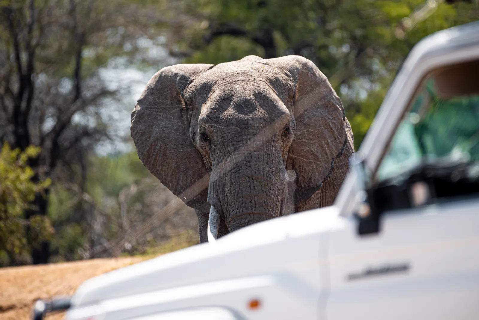
The best game drive routes in southern Kruger follow water and open grassland: the H4-1 along the Sabie River, the H4-2 and S28 between Lower Sabie and Crocodile Bridge, the H10 towards Tshokwane, and quieter gravel options such as the S25, S114 and the roads around Pretoriuskop and Berg-en-Dal. This guide explains where each route runs, how long to allow, what it is known for and how to combine routes into a good day.
The southern region, broadly from Skukuza and Lower Sabie down to Malelane and Crocodile Bridge, gets more rain than the rest of the park. Thicker vegetation supports a lot of game, the camps are close together, and the learning curve for self-drivers is gentler than in the remote north. That is why many first-time visitors start here (see North vs South Kruger).
Why the South Works, and Its Drawbacks
The Sabie and Crocodile rivers carry water all year, so wildlife never has to wander far to drink. Between them lie basalt grasslands with sweet grazing that attract zebra, wildebeest, buffalo and the predators that follow them. Facilities are close: Skukuza, Lower Sabie, Crocodile Bridge, Berg-en-Dal and Pretoriuskop are all within a morning's drive of each other, with picnic sites such as Nkuhlu, Afsaal, Mlondozi and Tshokwane in between (see picnic sites).
The downside is traffic. The H4-1 in particular is often described as the busiest road in the park, and South African school holidays, long weekends, December and Easter bring long queues at good sightings. In summer (roughly November to March) the bush is thick and green, so animals are harder to see and you need to drive slowly and scan.
Before You Drive: Speed, Timing and Gravel
- Speed limits: 50 km/h on tar and 40 km/h on gravel. For game viewing, 20 to 30 km/h is far more productive.
- Timing: The first two hours after gate opening and the last two before closing are usually the most active. Plan midday around a picnic site or camp, and always work back from gate and camp closing times.
- Gravel roads: All the S roads below are gravel and are normally fine for ordinary cars in dry conditions (see Do I need a 4x4?). After heavy rain, SANParks often closes gravel roads around Crocodile Bridge, Skukuza and Malelane, so check the boards at reception before you set out. Tips for driving them are in navigating dirt roads.
- Road codes: H roads are main (mostly tarred) roads, S roads are secondary roads. How to read Kruger road signs explains the system.
1. H4-1 Sabie River Road: Skukuza to Lower Sabie
Surface: tar. Distance: about 43 km. Allow: 2 to 3 hours one way with stops.
This is the classic southern drive. The H4-1 tracks the Sabie River through riverine forest and mixed thornveld, with many river views in the first stretch east of Skukuza. The riverine thickets hold a high density of impala, which in turn supports leopard, lion and spotted hyena. Elephant, buffalo, hippo, crocodile, waterbuck and fish eagles are regularly reported, and the large riverside trees are worth scanning for a resting leopard.
Stops: Nkuhlu picnic site, roughly halfway, sits on the riverbank with a shop and takeaway food, a good place for breakfast or a rest. Near the Lower Sabie end, Sunset Dam lies about 1 km from the camp gate and is one of the most popular waterholes in the park for hippo, crocodile and late-afternoon drinking herds.
Best time: Early morning, and the last hours before camp closing for Sunset Dam. Avoid the middle of the day in peak season, when sightings quickly attract long lines of cars. If the H4-1 is jammed, the gravel S30 (Salitje Road) on the north side of the river is a quieter alternative.
2. H4-2 Gomondwane Road: Lower Sabie to Crocodile Bridge
Surface: tar. Distance: about 34 km. Allow: around 2 hours, more if you stop at the dams.
The H4-2 was the first road built in Kruger and is still one of the best game-viewing roads in the south. It starts in mixed woodland with sweet grazing near Crocodile Bridge, then passes through dense thorn thickets before opening up into basalt grassland near Lower Sabie. Giraffe, zebra, impala, buffalo and elephant are common; lion, spotted hyena, white rhino and occasionally wild dog are regularly reported, and the open country near Lower Sabie is good for cheetah.
Stops: Gezantfombi Dam, about 5 km from Crocodile Bridge, often has elephant. Gomondwane Dam, at the junction with the H5, is an artificially fed waterhole where wildebeest gather. Both are short, easy sits.
Best time: Early or late in the day. As the main access road from Crocodile Bridge Gate it gets busy on weekends and holidays.
3. S28 Nhlowa Road and the S137 Duke Loop
Surface: gravel. Allow: 2 to 3 hours between Crocodile Bridge and Lower Sabie.
The S28 is the gravel alternative to the H4-2. It leaves the Crocodile Bridge area heading north-east towards the Lebombo hills and joins the H4-2 just south of Lower Sabie. It runs through flat, open basalt grassland with knobthorn and marula trees and pans that hold water long after the rains. Large herds of impala, zebra and wildebeest graze here, and the road is known for white rhino and above-average cheetah chances. Lion are regularly reported, and it is also one of the better birding roads in the south, with ostrich, bustards, korhaans and raptors.
Stops: The Nthandanyathi bird hide on the S28, roughly 11 to 12 km from Lower Sabie, overlooks a waterhole and is a good place to stretch your legs. The short S137 turns off to Duke waterhole, which holds water year-round and is a reliable stop at dawn. Nhlanganzwani Dam lies a few kilometres south of Nthandanyathi.
Best time: Morning, when cats are still active on the plains. The open landscape makes this a good road in summer too, when the H4-2 thickets are at their densest.
4. H10 and the S29 Mlondozi Loop: Lower Sabie to Tshokwane
Surface: H10 tar, S29 and S122 gravel. Distance: about 43 km from Lower Sabie to Tshokwane. Allow: half a day with detours and a Tshokwane stop.
The H10 heads north from Lower Sabie along the Lebombo foothills and through the south-eastern grasslands, one of the most scenic drives in the south. Expect giraffe, zebra, wildebeest and buffalo on the plains, with lion regularly reported.
Detours and stops: Soon after the low-level bridge near Lower Sabie, the 14 km S29 skirts the Lebombo and rejoins the H10 near Muntshe Hill. On it, Mlondozi picnic site overlooks Mlondozi Dam with wide views over the plains. The 12 km S122 circles Muntshe Hill and is especially pretty in the wet season. Further north, Nkumbe lookout gives a broad view over the eastern plains, and Tshokwane picnic site (with a small shop and food) is the natural turning point.
Best time: Morning. If you have a whole day, combine it with the H1-2 and H4-1 for the full "Southern Triangle" via Tshokwane and Skukuza.
5. S25 Crocodile River Road
Surface: gravel. Allow: a morning out and back from Crocodile Bridge, or most of a day through to the Malelane side.
The S25 runs west from Crocodile Bridge along the Crocodile River through thicket and grassland, eventually linking to the roads near Malelane and the Biyamiti area. It is known for raptors, including martial eagle, and for general game along the river. About 8 km from the gate, the S27 turns off to Hippo Pools, where hippo and crocodile are usually present.
Best time: Early. The road is popular and unshaded, so it gets very hot in summer, and the vegetation becomes denser further west. It is often among the first roads closed after heavy rain.
6. S114: Malelane to Skukuza the Slow Way
Surface: gravel. Allow: a good half day, more with detours.
The S114 is the dusty alternative to the tarred H3 between the Malelane area and Skukuza. It runs north through the Mhlambane basin, past Biyamiti Weir and Renosterkoppies, before joining the H1-1 near Skukuza. Traffic is usually lighter than on the tar, and the road is known for leopard, elephant and buffalo.
Detours: The 16 km S23 Biyamiti Loop follows the river before rejoining the S114, and cheetah are sometimes seen there. The S118 Mhlambane Loop has viewpoints over the riverbed where elephant and buffalo are sometimes seen. If you prefer tar, the H3 via Afsaal picnic site (restaurant and shop) is the direct route; allow about three and a half hours including a break.
Best time: Morning or late afternoon. In the dry winter it can be dusty.
7. H1-1 Napi Road and Transport Dam
Surface: tar. Allow: 1.5 to 2.5 hours between Pretoriuskop and Skukuza.
The Napi Road runs from Numbi Gate past Pretoriuskop to Skukuza, descending from granite foothills into bushwillow woodland and then thorn thickets. It follows the watershed between the Sabie and Crocodile catchments.
Stops: Shitlhave waterhole near Pretoriuskop is good for southern reedbuck and waterbuck. Transport Dam, close to the H1-1, marks the start of the sweetveld and is a good place for zebra, buffalo, elephant and early-morning lion; it became famous as the site of the "Battle at Kruger" video. Mathekenyane (Granokop), closer to Skukuza, is a hill lookout with a view over the upper Sabie valley.
Best time: Early morning for lion near Transport Dam. The gravel S65 is a quieter alternative between Transport Dam and Skukuza.
8. Pretoriuskop: H2-2 Voortrekker Road
Surface: gravel. Allow: 1.5 to 2.5 hours between Pretoriuskop and Afsaal.
The historic H2-2 follows the old transport riders' route and descends from Pretoriuskop's sourveld into rolling bushwillow woodland. Its main landmark is Ship Mountain, a gabbro outcrop shaped like an upturned hull. The wider Pretoriuskop area is known for white rhino, and the thicker sourveld occasionally turns up sable antelope, which are rare in the south. The road is also closely linked with the story of Jock of the Bushveld.
Best time: Morning. Combine it with the H3 and H1-1 for a loop from Pretoriuskop via Afsaal and back.
9. Berg-en-Dal: S110 and the Matjulu Valley
Surface: S110 partly tar, partly gravel. Allow: 1 to 2 hours for a loop from camp.
Berg-en-Dal sits on the Matjulu Spruit among granite hills, a different landscape from the rest of the south. The S110 runs along a ridge into the Matjulu valley; the tarred section is the direct road from Malelane Gate to camp, while the gravel section via the Matjulu Loop is the scenic option. White rhino, kudu, giraffe, klipspringer and elephant are regularly seen, wild dog and hyena hunt here, lion are frequently reported, and leopard are seen regularly in the area.
Best time: A short morning or late-afternoon loop when you do not want a long drive. Combine it with the H3 northwards for a half-day trip to Afsaal.
Sample Days
- Lower Sabie, one full day: Sunset Dam at gate opening, the S28 to Crocodile Bridge with a stop at the Nthandanyathi hide, back on the H4-2 via Gomondwane Dam, then Sunset Dam again before closing. A detailed version is in One Perfect Day: Lower Sabie to Crocodile Bridge.
- Skukuza, one full day: The H4-1 at dawn with breakfast at Nkuhlu, the H10 north via Mlondozi to Tshokwane, then the H1-2 back to Skukuza.
- Berg-en-Dal or Malelane, half day: The S110 Matjulu Loop at dawn, then the H3 to Afsaal for brunch and back, or the S114 if gravel roads are open.
More ready-made options, filterable by camp and interest, are on our curated routes page, and you can find water stops on the waterholes map.
Summary Table
| Route | Between | Surface | Allow (approx.) | Known for |
|---|---|---|---|---|
| H4-1 | Skukuza to Lower Sabie | Tar | 2-3 h | Leopard, lion, river game, Nkuhlu, Sunset Dam |
| H4-2 | Lower Sabie to Crocodile Bridge | Tar | About 2 h | Elephant, buffalo, rhino, Gomondwane Dam |
| S28 + S137 | Crocodile Bridge to Lower Sabie | Gravel | 2-3 h | White rhino, cheetah, plains game, Nthandanyathi hide |
| H10 + S29 | Lower Sabie to Tshokwane | Tar / gravel | Half day | Scenery, plains game, Mlondozi Dam |
| S25 | Crocodile Bridge westwards | Gravel | Morning to full day | Raptors, Hippo Pools (S27) |
| S114 | Malelane area to Skukuza | Gravel | Half day or more | Leopard, elephant, buffalo, Biyamiti |
| H1-1 | Pretoriuskop to Skukuza | Tar | 1.5-2.5 h | Transport Dam, lion, reedbuck |
| H2-2 | Pretoriuskop to Afsaal | Gravel | 1.5-2.5 h | White rhino, Ship Mountain, history |
| S110 | Berg-en-Dal / Malelane | Tar / gravel | 1-2 h | Rhino, granite hills, Matjulu valley |
FAQ
Which is the single best road in southern Kruger? For a first visit, the H4-1 between Skukuza and Lower Sabie is hard to beat for variety, especially early in the morning. If you dislike traffic, the S28 is the best quieter alternative.
Can I drive these routes in a normal car? Yes. The H roads are tarred and the S roads are graded gravel that normal cars handle in dry weather. Drive slowly on gravel and check for closures after rain.
Where is the best place to see rhino in the south? The S28 near Crocodile Bridge, the Pretoriuskop area and the hills around Berg-en-Dal are all known for white rhino. Sightings are never guaranteed.
Where should I stay to use these routes? Lower Sabie is ideal for the H4-1, H4-2, S28 and H10. Skukuza suits the H4-1, H1-1 and S114. Crocodile Bridge gives early access to the S28 and S25, and Berg-en-Dal or Pretoriuskop are best for the south-west. Two to three nights in the south lets you drive several of these routes without rushing.
Read also: Top Waterholes for Dry Season, Picnic Sites and Rest Stops and Sighting Traffic Etiquette.