How to Read Kruger Road Signs and Map Codes (H vs S Roads)
Kruger National Park has more than 3,500 km of roads. To a first-time visitor, the map looks like a bowl of spaghetti labelled H1-1, S65, and R536. Once you understand the coding system, route planning becomes intuitive-and you will stop accidentally driving into one-way loops or closed seasonal tracks.
The Basic Alphabet
| Prefix | Meaning | Surface | Typical use |
|---|---|---|---|
| H | Main road | Mostly tar | Fast travel between regions |
| S | Secondary / scenic | Mostly gravel | Game viewing, quieter loops |
| R | Regional (outside park) | Tar | Access roads to gates |
H-roads are the arteries. They are wider, faster (50 km/h max), and busier-but excellent for covering distance at dawn before branching onto gravel.
S-roads are where Kruger feels wild. Narrower, slower (40 km/h max), less traffic, and often better for unexpected sightings. See our full Dirt Roads Guide.
One-Way Roads
Some S-roads are one-way only-especially loops near riverbanks or steep terrain. One-way roads are marked "(one way)" on the sign. Ignoring this is dangerous (oncoming traffic on narrow gravel) and can damage the road surface.
Always check for one-way signs before entering an unfamiliar S-road.
Seasonal Closures
After heavy rain, SANParks closes vulnerable gravel roads. Closure boards appear at:
- Camp gates (check every morning)
- Road junctions (physical barrier or sign)
Never drive around a closure barrier. Soft roads tear up easily and stranded vehicles are costly-for you and the environment.
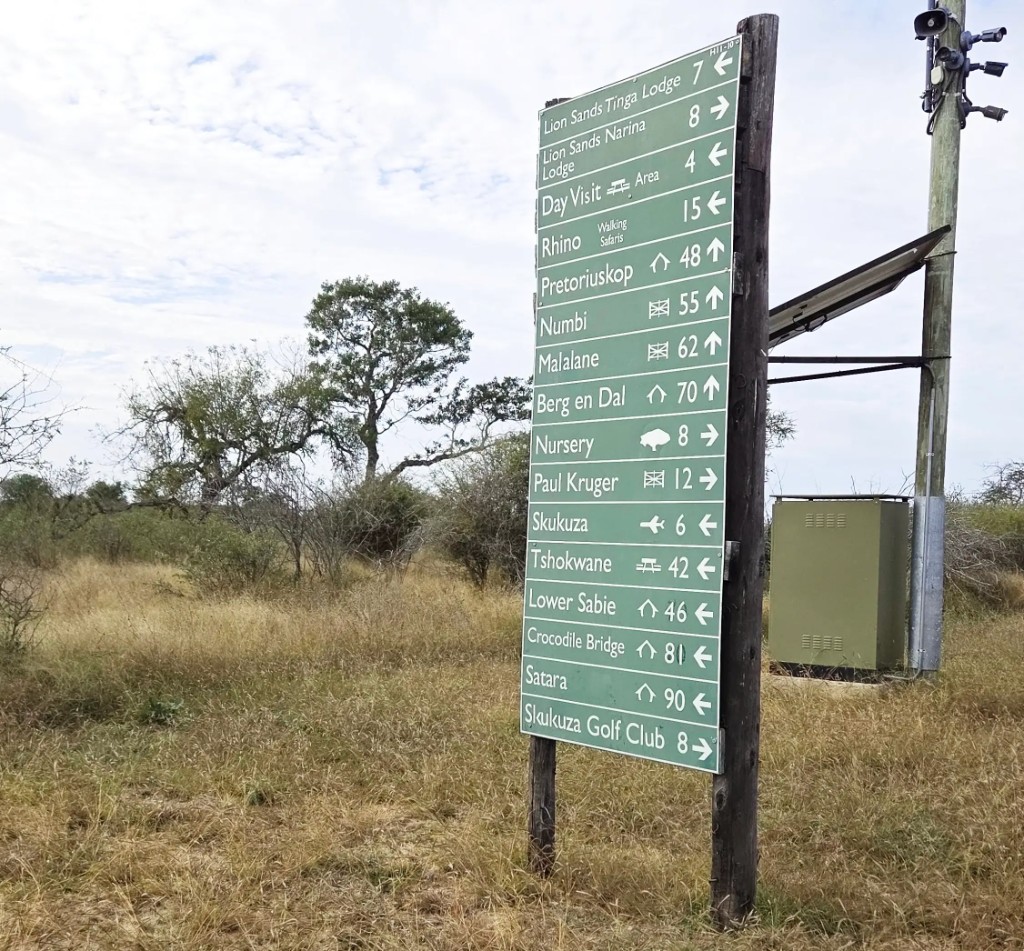
Physical Road Signs Inside the Park
Common signs you will encounter:
Speed limit - 50 on tar, 40 on gravel.
No entry / (one way) - self-explanatory; turn around if unsure.
Gate distance markers - helpful for judging return time against gate closing.
Picnic site / viewpoint - blue or brown tourism signs; only exit vehicles where officially permitted.
Animal crossing - warning, not a guarantee-but slow down and scan.
Using H and S Roads Together: A Template
The most effective self-drive pattern:
- Tar out early - reach a target region quickly at gate open
- Gravel explore - spend the productive morning on S-roads
- Tar home late afternoon - reliable surface when you are tired and racing the clock
Example south loop: H4-1 north → S128 east → S129 → H10 back toward Lower Sabie.
Map Pitfalls for Beginners
Driving the long way - two camps may look close on a map but connect only via a distant H-road. Use the app's route planner for realistic drive times.
Dead-end spurs - some S-roads end at river loops; you must return the same way. Factor time for the return leg.
Confusing gate roads - the R-road to a gate is outside camp; the H-road network starts inside. Fuel and shops are not at every gate.
Road Hierarchy and Etiquette
On narrow gravel, yield common sense:
- Smaller vehicles pull aside for larger safari trucks when safe
- Do not stop in the travel lane-park on the side of the sighting
- Dust means drop back; overtaking blind on gravel is reckless
Practice Exercise
Before your first drive, open the map at your camp and trace:
- One H-road escape route to tar
- Two nearby S-road loops under 20 km each
- The nearest picnic site and fuel point
Fifteen minutes with the map saves hours of confusion in the field.
Related Guides
Learn the codes once, and Kruger's road network opens up like a book-one S-road chapter at a time.